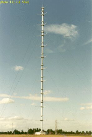
Cabauw 213 m high meteo mast
ATMOSPHERIC BOUNDARY LAYER RESEARCH AT CABAUW
The Cabauw mast is located in the western part of the Netherlands
(51.971 øN,
4.927 øE) in a polder 0.7 m below average sealevel. This site
was chosen, because it
is rather representative for this part of the Netherlands and because
only minor
landscape developments were planned in this region. Indeed the present
surroundings of
Cabauw do not differ significantly from those in 1972. The North Sea is
more than 50 km
away to the WNW.
The nearby region is agricultural, and surface elevation changes are at
most a
few metres over 20 km.
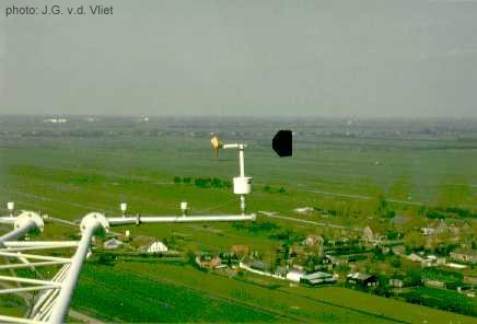
Near the mast, the terrain is open pasture
for at least 400 m in all directions, and in the WSW direction for 2
km. Farther
away, the landscape is generally very open in the West sector, while
the distant
East sector is rather rough (windbreaks, orchards, low houses). The
distant North
and South sectors are mixed landscapes, much pasture and some
windbreaks. So the
highest mast levels have in all directions a long fetch of landscape
roughness
which is usefully similar to the roughness observed in the lower
surface layer.
On the mast itself no undisturbed measurements can be made below 20 m.
Auxiliary 20 m masts are installed to the SE and the NW at sufficient
distance
from the mast foot building. South of the mast is a well-kept
observation field
for micrometeorological observations, including soil heat flux, soil
temperatures
and various radiation measurements; north of the mast is a spare
observation field.
The soil consists of 0.6 m of river-clay, overlying a thick layer of
peat. The water
table is about 1 m below the surface, but can be higher during wet
periods. For further information see the website of (Fred
Bosveld)